These instructions ONLY apply to expansion claims for existing nations. If you do not yet have a nation on the map or want to create an additional one follow these instructions instead.
All change requests must be made within this thread. Depending on the nature of your request, it may need to be voted on or discussed by the Cartography Department. Remember to avoid place names from real life and never use names from copyrighted works.
These requests generally don’t require a vote or discussion:
Changing labels (national, cities, etc.)
Adding, moving, or removing cities
Minor corrections
Reasonable yearly stat changes
These requests generally do require a vote or discussion:
Major stat changes
Major, sweeping changes to your nation
Adoption requests
Some requests may be partially accepted or denied entirely if there is no space on the map (or for other reasons).
If your request does not require a vote, you will not receive a reply from the Cartography Department. It will simply be added to our to-do list for the next map update.
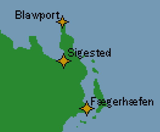
I have request to be made about Atlalandr cities first being to rename Jotundal to Atlaborg and make that into a capital. Rename Ukonvasara to Ulvrik, rename Fjellborg to Østtårn and Etruria to Fjellborg
Hi folks, while I plan to continue and eventually resolve the plot of l’Era d’Ira, I have come to the conclusion that it’s best for the story of Novaris to be able to move on in real time, so I’m preemptively submitting this map change to allow me to begin the latest roleplay chapter in West Novaris.
No stats are changed, but as the League of Novaris occupation has come to an end, please remove the (LN) from Cavellan’s name. Updated basic national information is provided below.
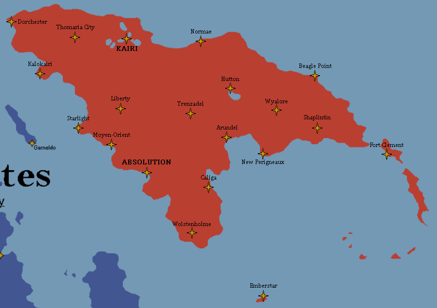
Absolution is the capital city
Kairi is the largest city
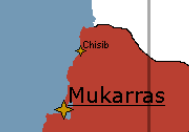
If you’re able to, maybe put the ‘Cappedore’ label on the map to the right of the main landmass? Otherwise it may collide with some of the city labels in the middle! Thanks
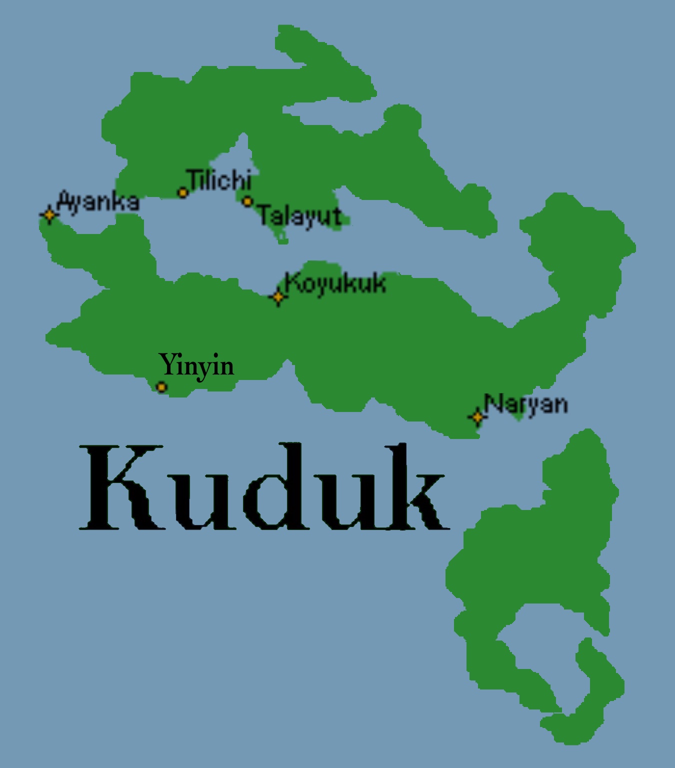
I wanna do two thingies with Kuduk on the map! I want to add a new town named “Yinyin” (shown on the image)! I also want to move the “Kuduk” nation name text over to the empty water area next to Kuduk to allow for more breathing room for any future settlements in that area!
Hi, I would like to request changing the map to reflect Tangrland’s new status as an independent nation that no longer part of Norgsveldet’s Imperial Realm… Also please change their colour to blue so its same as Meremaa’s
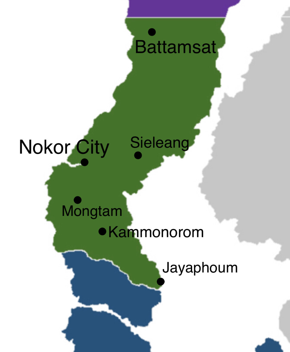
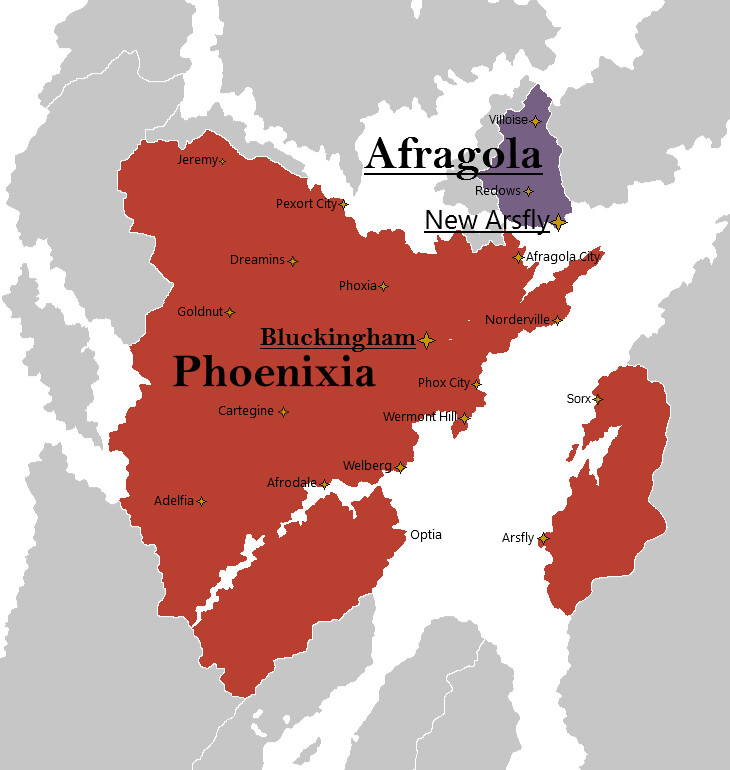
First of all a general redo of all the cities. I would also like to change the status of Afragola to indipendent and make its colour purple. Provided below is a rough map of the desired changes. Thank you
I am making the decision to reduce my number of countries in order to be able to better focus on the core group of what I consider to be my best contributions to our shared Urth canon.
Please remove the following countries from the map:
Asilica
Bana
The Danvreas
North Ni-Rao
Reijia
Rusanru’a
South Ni-Rao
Vesienväl
Please also note that I am removing myself from these countries that are owned by multiple people:
I return the United States of Mexregiona to the care of the cartography team.
If anyone wishes to adopt any of these countries I have no objection, but ask that any new owner change the name of the country and the names of all cities on the map.
Hey all! Because of this adoption, I have decided to rename Rusanru’a. Attached is the .png for the new names, because the .xcf file is too big for Discourse. Thank you!