Behind the scenes, I have worked with Cartography to significantly shrink Morstaybishlia as us Aurorans aimed to streamline borders, something we have wanted to do since 2016.
Seperately, as that has come and gone, I require some more changes that I will post here so it is on record.
Caltharus → Kaltar
New Calthia → New Kaltar
Aeternum → Damezkador
Morstaybishlian West Cerenerian Territories → Morstaybishlian Cerenerian Territories
Justelvard → Jusdelva
I have already revised all of the cities for Valeria now it has moved, kindly supplied to Turtle and hopefully transplanted on the map. I will do the same for Staynes, Kaltarus, the Ethalns, and MCT in the following days.
Hey deities of the MAP.
I would like to request the removal of Ny’Natrotomi from the map, and the cities Ny’Tažriby, Tevirnor, Ny’Deverina moved to Bana located here where the red dots are. It doesn’t matter which order they’re in.
After a whole lot of years, so many I can’t even remember, and at last after much thought, the Cooperative Commonwealth of New Leganes, the Oblivion Islands and Shoneria comes to an end, and its official name will be, from now on, the Cooperative Commonwealth of the Impelanzan Ocean (LLNTV (National Cukish Television) - #10 by Sammy23). Together with this change, the time has come to ask for a map change that reflects correctly the IC nature of what we know OOCly as “NL”: I would like the country name displayed for NL on the map to be “Cooperative Commonwealth of the Impelanzan Ocean” or, alternatively, “Cooperative Commonwealth”, while New Leganes (without the acute, since it’s a Staynish name and not a Cukish one), would this way shown in the same category as “Oblivion Islands” and “Shoneria”, as one of the country’s three archipelagos. This may get confusing, so I’ll gladly answer any doubts about it. Thanks in advance lovely Cartos .
Hello again! This is not the request I am going to make for city placement or some minor city name changes I mentioned. That’ll come next.
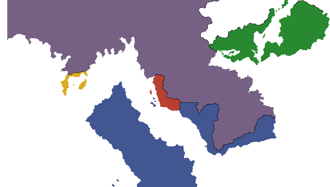
Me and Oan were talking before the map update about making our borders more natural based on a more topographical form. I gave him a proposal that he was sleeping on since it would be a change to maps he had already done.
We have also decided to change the name of Lyon to Tarseen with the capital being Astylon. It should be contested as well.
2 minor notes of the last map update that need to be fixed. One of my former cities, Windfall, has been placed on the border of Packilvania and Jiduan and should be removed. Iseul (PGA) to Iseul (FPS).
After careful consideration, I have decided to retcon/change the name of Nagato to Elissia. The full name of this “new” nation is the Plurinational Republic of Elissia. I will also keep the flag, may change this later…
If you have any questions regarding this change, please let me know.
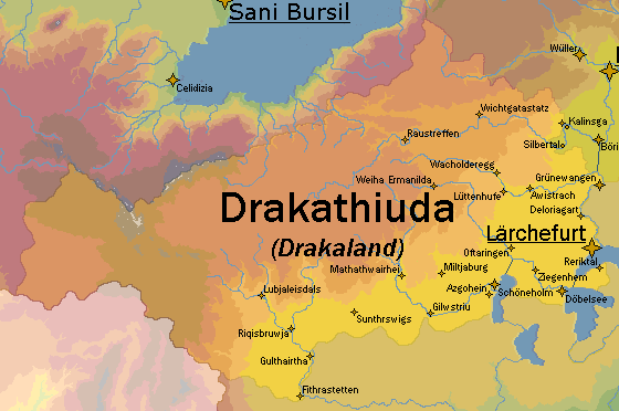
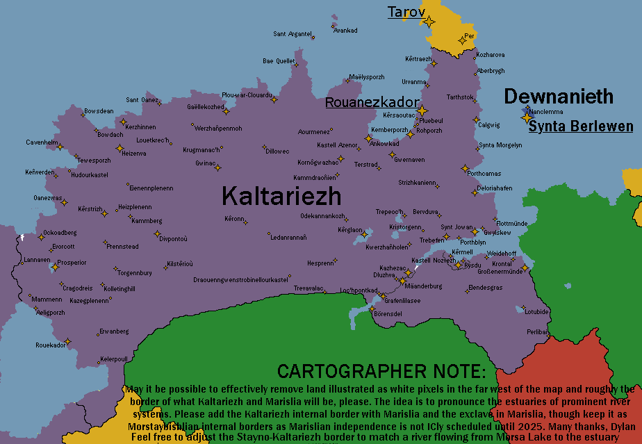
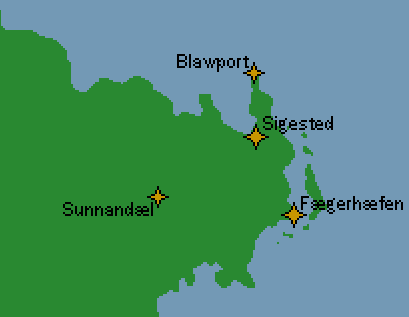
My two week conclusion to renaming cities in Kaltariezh, Marischen and Dewnanieth. Please replace all cities with the ones on this map.
In this, I am requesting the establishment of a new nation from within the borders and stats of Kaltariezh, which you can find on its wiki page.
DEWNANIETH
Capital: Synta Berlewen
Population: ~5.63 million
Density: 3580 ppl per km2
GDP PC: 53,996 KRB
GDP: 304,021,346,232 KRB
Deducting population and gdp averages from the MBE + Marislia pot. This will be a highly urbanised island nation, hence the population density.
Species will be dominantly Cava, language Cornish/Terghyntek (next to its sister language Breton/Kaltareg, and evolved from the same language family: See Usprian languages on TEPwiki).
History:
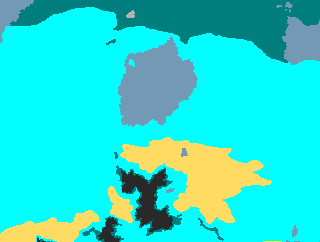
I made a crude history map of Dewnanieth which will be attached. Essentially it is the fourth iteration of what was once a larger nation that encompassed land in todays Marislia, east Dovian Cape, all the way down to the mouth of the Krosenau / Ider / Aberbish (Beghirac is the island name in Kaltareg). The nation came to be in its original form as a splinter of Ethalria during the Ethalrian War of Succession (will be canonically implemented in the coming week hopefully), specifically in the year 1703. Before then these lands (including the modern Dewnan island) was subjucated by the Kaltariezh and Ethalrian empires in the centuries leading up to independence. Ethalrian expansionism rendered the Kingdom of Terghyntin smaller, by the end of the Great War it became the Federation of Terghyntin. Then later the Terghyntek Republic, then later Dewnanieth (the island component only) after the Auroran Imperial War.
Both Terghyntin and Dewnanieth have Cornish etymology from Proto-Celtic, so if you’d like to know, feel free to ask.
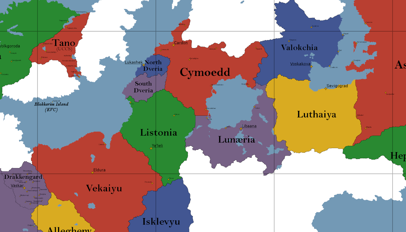
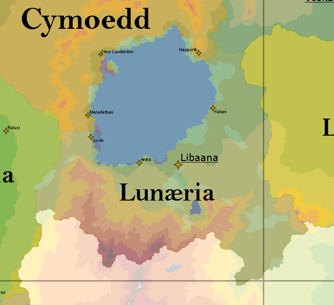
i would like to relocate Lunaeria to Yasteria as i had previously mentioned. stats would remain unchanged, but the nation is a good bit larger to accommodate for topography.
87,910 px → 107,307 px (557,460 sq km → 680,461 sq km)
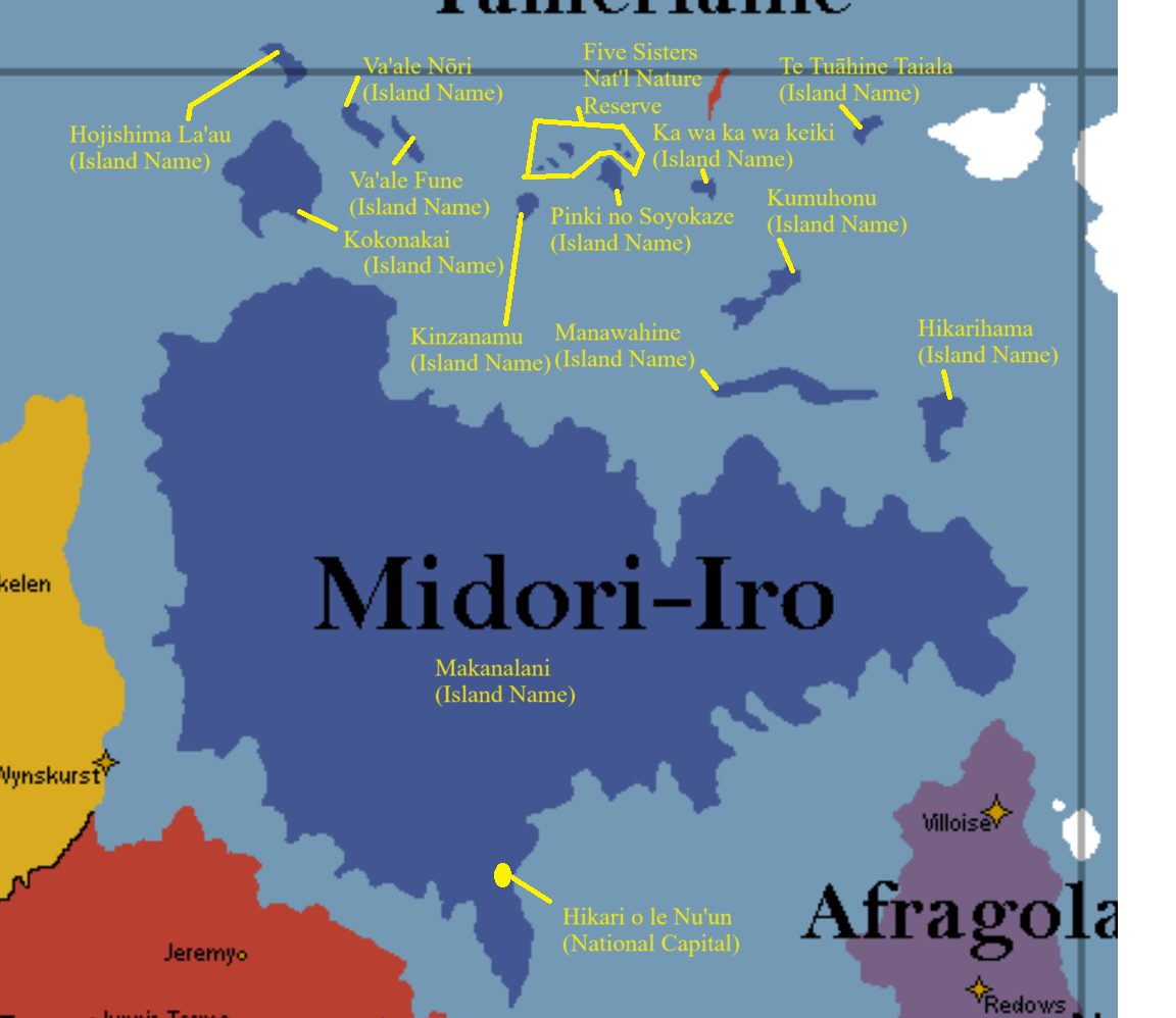
Hi there @emerald_raider , not sure if you received a response from anyone else in the department, but we will not add these island names. We only add island/territory names (in italics on the map) if it is reasonably far away enough from it’s nation core to do so. Additionally, they would be very tightly packed together here and would not look particularly nice.
Feel free to use these island names on your personal maps and in your worldbuilding/RP, but they will not be added to the map.
We will happily add the capital city though, and we’ll add cities elsewhere in your nation (including on the islands) if/when you provide them to us.
Thank you,
turtle, on behalf of the Cartography Dept.
(If you have any questions, open a ticket on discord)
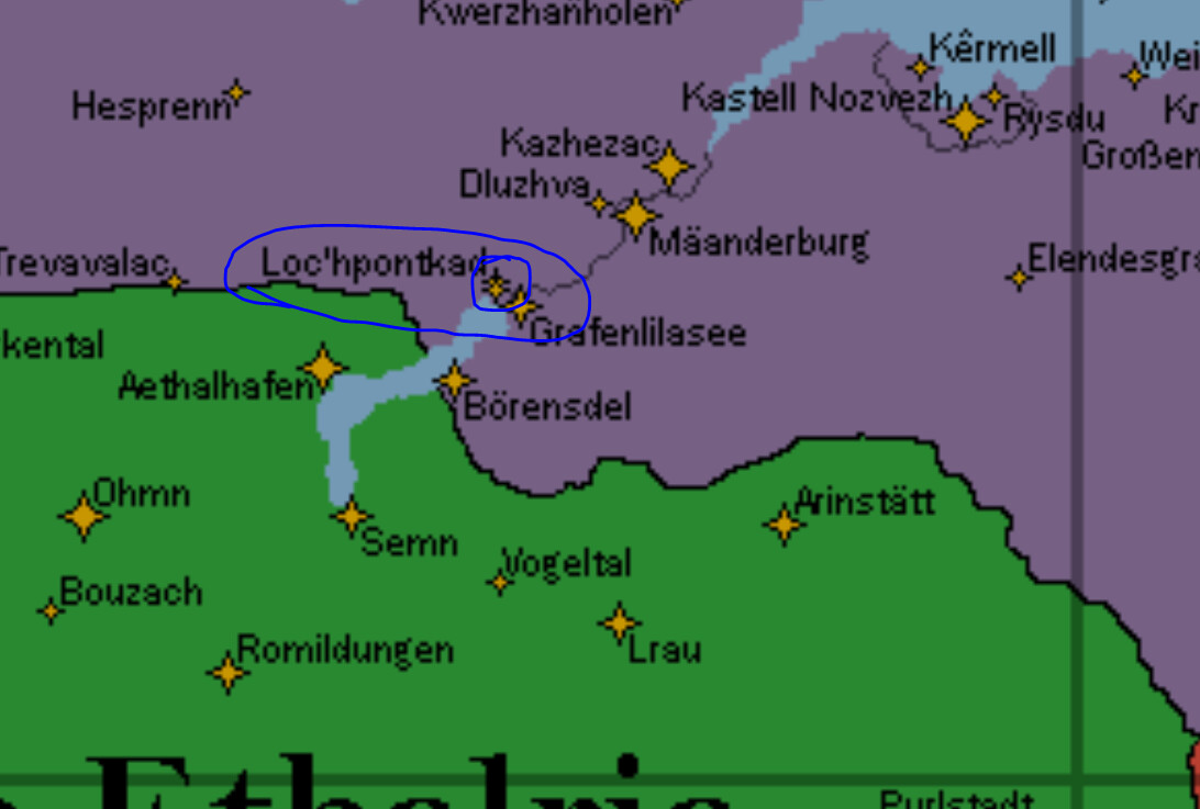
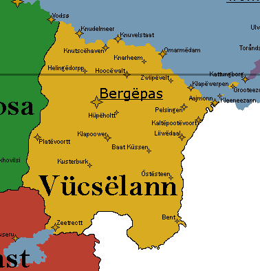
In the middle of the claim, Klappoower should be Klapoower.
Near the middle of the coast, Knarëhem should be Knarhem
At the east border near the coast, Kaltëpootvoort should be Kaltëpootëvoort.
These changes come as I have finalized the orthography rules, and should be final, I hope.