Two changes this time, both in North Gondwana. I come bearing xcf files so I hope they will be useful - naturally feel free to amend to taste.
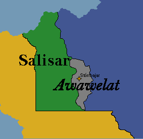
First is Awawelat, a partially recognized state in southeastern Salisar. It has a population of 1,133,036 and information on it can be found here: East Awawelat - TepWiki. Generally I’d suggest asking Nrogs if you’d like any more information.
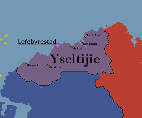
Next is Malaipaki, which has been reworked mostly from scratch as Yseultijie, a joint project between me and Luna. It maintains the present stats of Malaipaki as seen on the Carto Study. Information on it can be found on this wiki. Yseultijie - TepWiki.
Hello cartographers, just wanted to state a few new infos regarding Sigeta (that I’m sending for approval):
It’s population (11,164,641) and GDP ($225.05 billion) does not include one region (Fehérőd).
Fehérőd has a population of 4,149,392 and a GDP of $151.07 billion (it’s SDI would be around 0.83).
Fehérőd is basically similar to Hong Kong, but it is still part of Sigeta (one nation, two systems type of situation, though in this case it’s for economic development).
Therefore, taking Fehérőd into account, Sigeta would have a population of 15,314,033, a GDP of $376.12 billion, a GDP per capita of $24,560 and an SDI of 0.80. That is all.
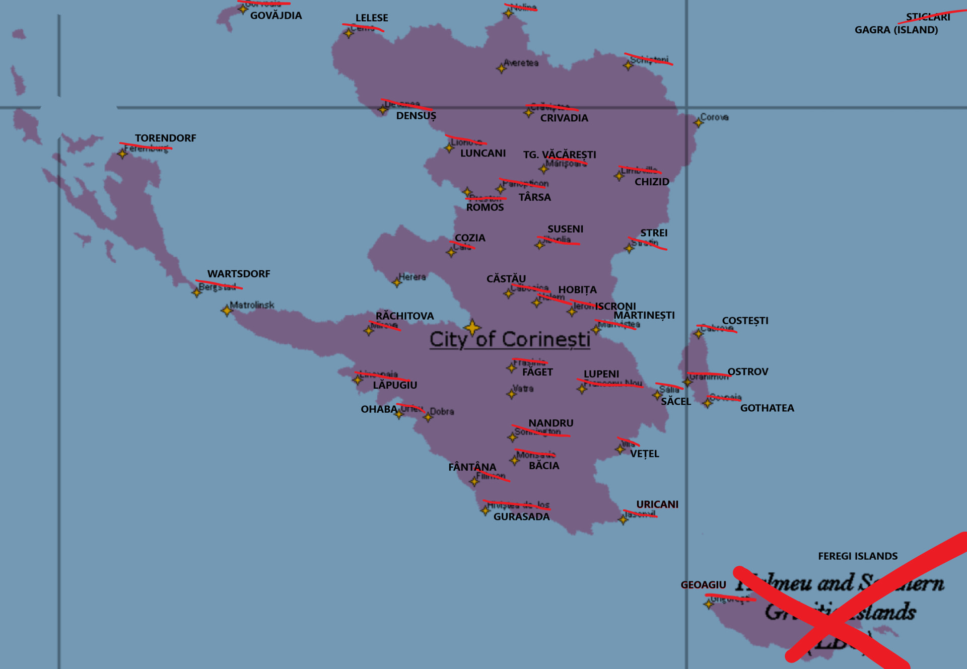
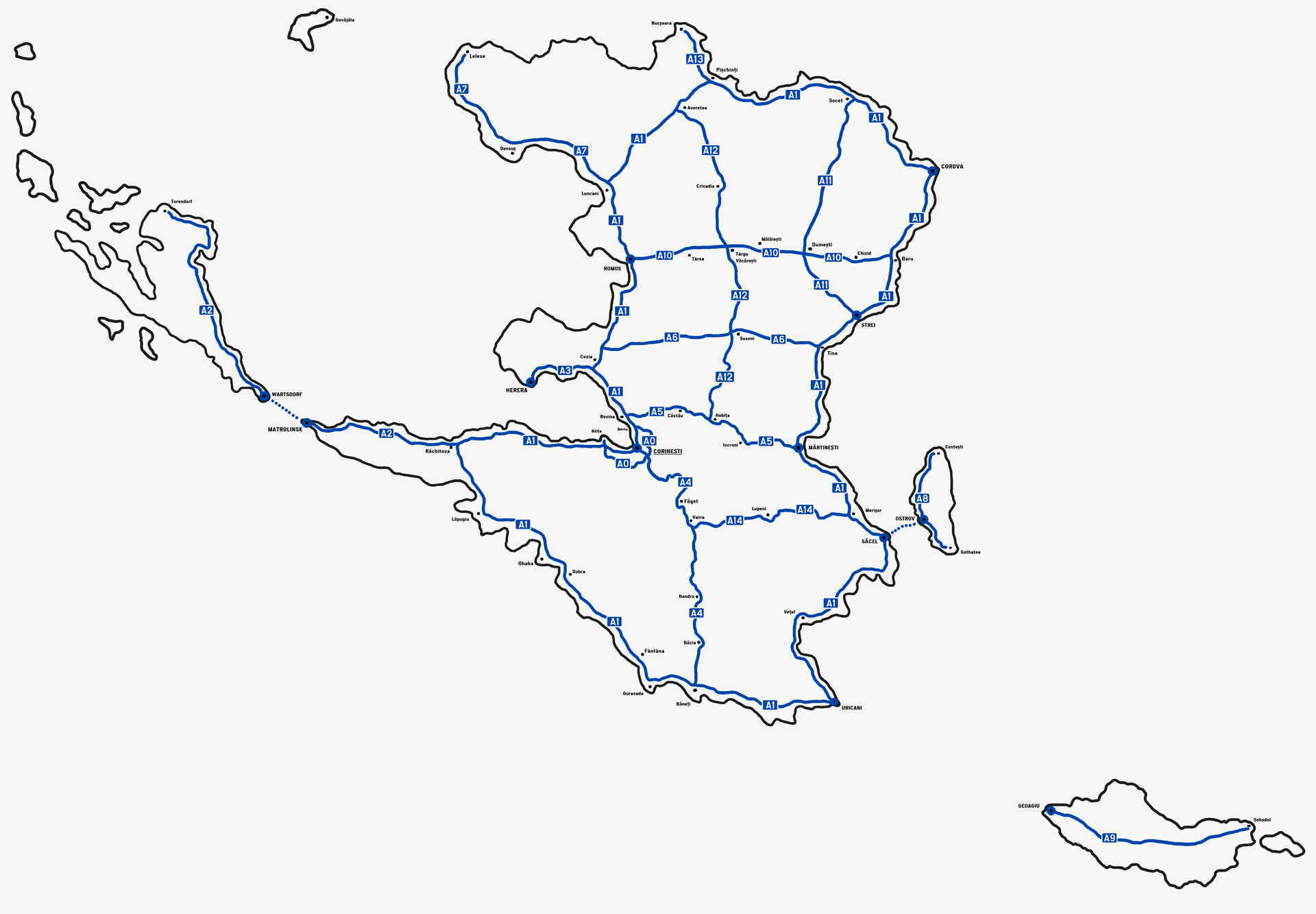
Hi, dear cartographers. It is me (again), but this time with a large overhaul of the names of Limbo’s main cities and towns (the ones shown on the map). I tried to make this more legible, because I also made a larger map with more cities.
Also, Sticlari is no longer named as such, but rather as Gagra Island (has only one settlement, same name, don’t need to add it lol). And you don’t have to add the name of the Halmeu and Southern Grivita Islands name to it, just the settlement on the island (if it is possible, since Limbo is the only purple nation in that corner of Urth).
Here are the diacritics for some of the names, in case you need them: Ăă Ââ Îî Șș Țț. If the font doesn’t suport these diacritics, you can just write the names of the towns without them (Ă and  as A, Î as I, Ș as S and Ț as T).
Thank you and have a great day (˶˃ ᗜ ˂˶) PS: if the detailed image is too blurry, then use the one in here.
EDIT: I realized that I forgot to add two other cities in the modified map with larger city names: Nolina, which is now Nucșoara, and Schișteni which is now Socet.
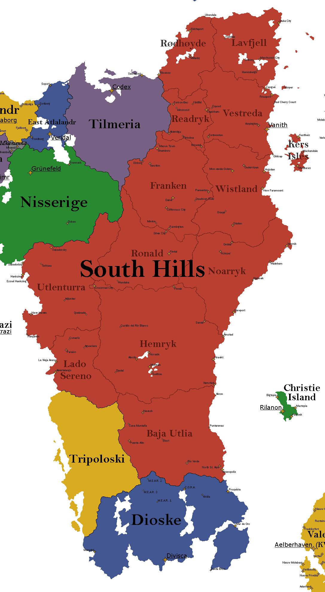
I along with the owner of Dioske went through and developed names for cities and settlements throughout Dioske and South Hills. I humbly request the following to be added!
Good afternoon Map Slappers United and Cartography, I’m requesting a stats update/change on the Federation of Lapérouse, it is a big change but is to reflect the on-going baby-boom that is impacting roughly 1/3 (40%) of the population. It is part of the overarching crisis with Lapérouse and has been referenced a fair bit across different RPs;
Population: 59.2 million
GDP: $2.56 trillion
GDP per capita: $43,240