Hi all.
I have an exciting map change following a referendum in Tawuse (Click here).
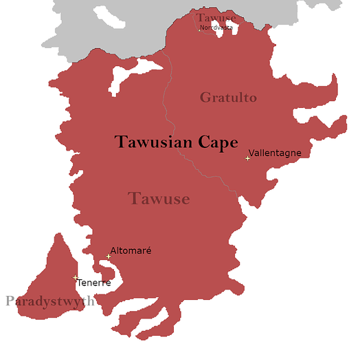
Following this referendum, Tawuse is to change its name to The Tawusian Cape. There is no external border changes to the Cape. However, internally, The Tawusian Cape consists of three federalised states that (if possible) I would like to be displayed (See attached screenshot).
Specifically, there are three states: Tawuse, Gratulto and Paradystwyth, all with their respective capitals that I would like to be displayed. Additionally, Tawuse has territory at the North of Gratulto, which I have marked with the city of Norrdvasta for reference.
Other than these internal border changes, all cities on the current map haven’t changes.
On an international level, the states act as one with the same currency. The overall population of the Cape is not different to that of the original claim of Former Tawuse. Wikis etc will be updated in weeks to come as my work allows.
Thank you for your time!
Phos
